Today 3D technologies are one of the most important areas of design automation, no one has
there is no longer any doubt about the need for their use both at the design stage, directly during the construction of industrial facilities, for reconstruction, overhaul of buildings and for restoration work of historical heritage sites.
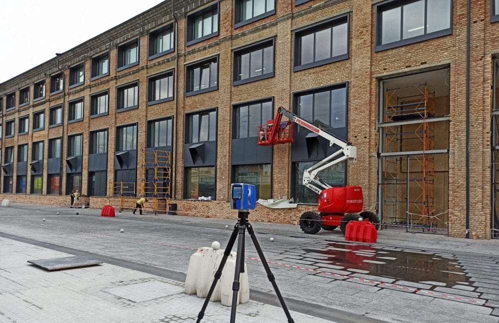
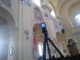
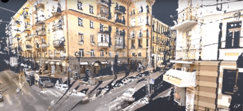
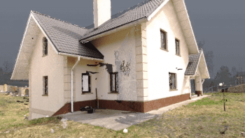
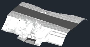
We carry out measurement work using technologies of ground, mobile and air three-dimensional laser scanning. It is the safest and most cost-effective method for surveying buildings and infrastructure facilities. The resulting point cloud reflects the smallest details of the structure and opens up a wide range of possibilities for analysis, measurements and competent decision-making regarding an object.
3D scanning
3D scanning of objects of any complexity
In industry
Allows you to find damage, deviations and destruction, fit equipment into a given volume, design networks for connecting equipment.
Objects of real estate
Creation of 3D models in Revit, Archiсad, 2D models, flat drawings in AutoCAD dwg of buildings, facades, preservation of cultural heritage.
3D scanning of parts - reengineering
Reverse engineering services. We create accurate models of various parts.
3D design
We design industrial, residential buildings, roads, carry out reconstruction and restoration projects
Equipment installation
We do 3D projects for the installation of any equipment (including on ships) in a given limited space.
Overhaul of buildings
3D projects and flat (2D) projects for major repairs or reconstruction of buildings.
Design of roads and sidewalks
We design roads quickly, efficiently, in accordance with the current standards, we pass the examination. With us you can be sure – we will not miss a single centimeter of the scanned space – the error is no more than 2 mm.
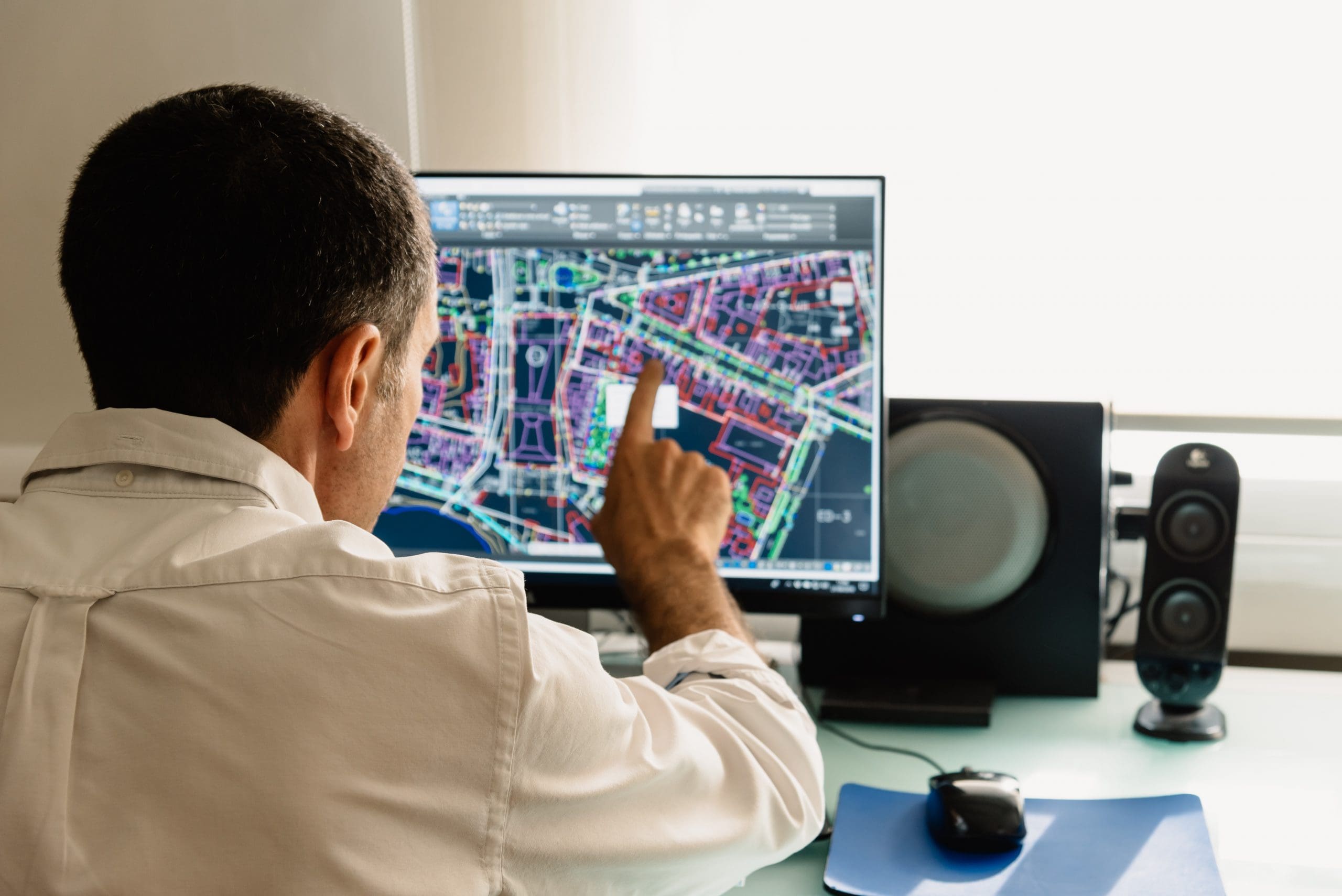
BIM models
Let’s create a BIM model of various degrees of detail (LOD100 – LOD500). We work with the clouds of the customer’s points or make a scan with our equipment.
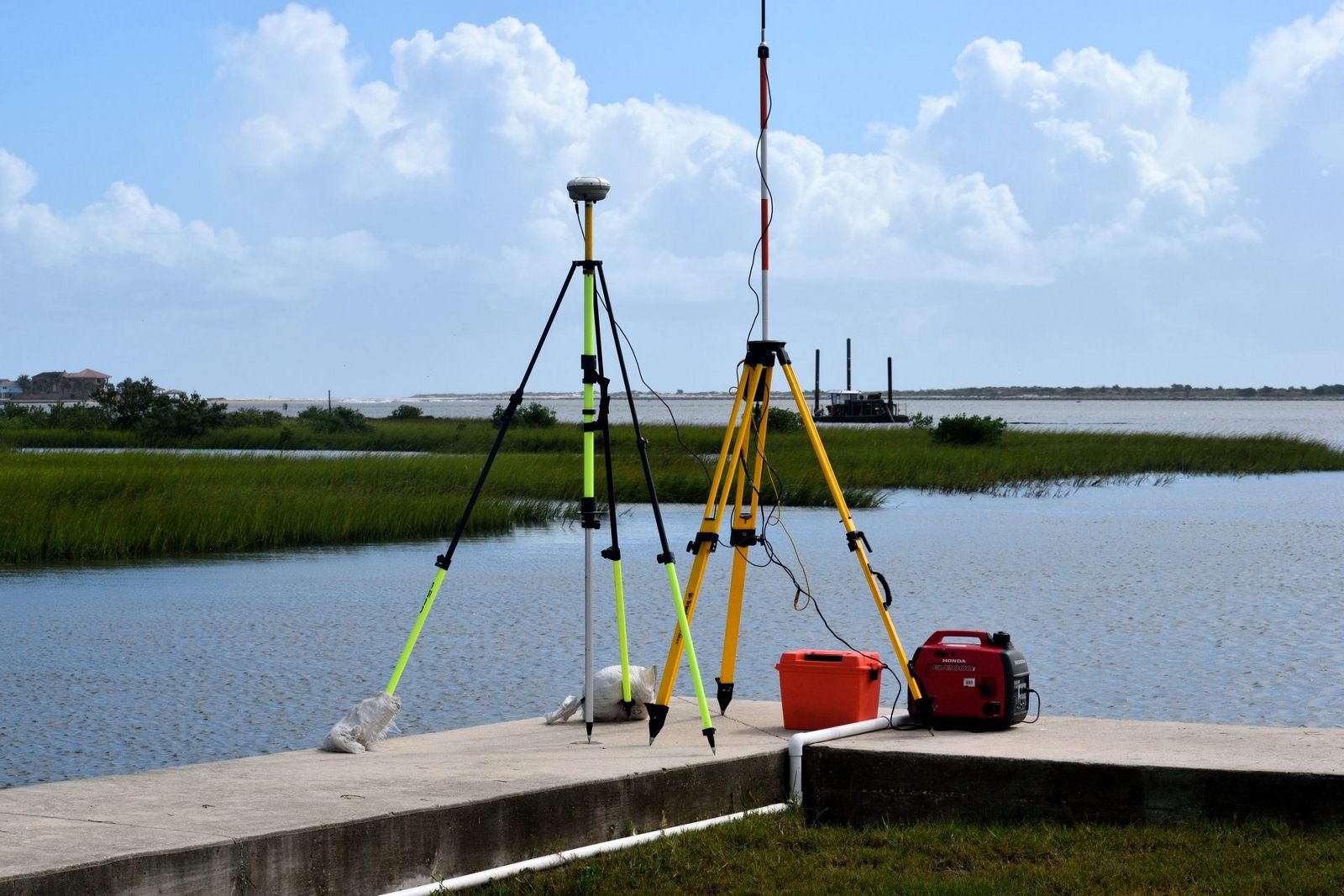
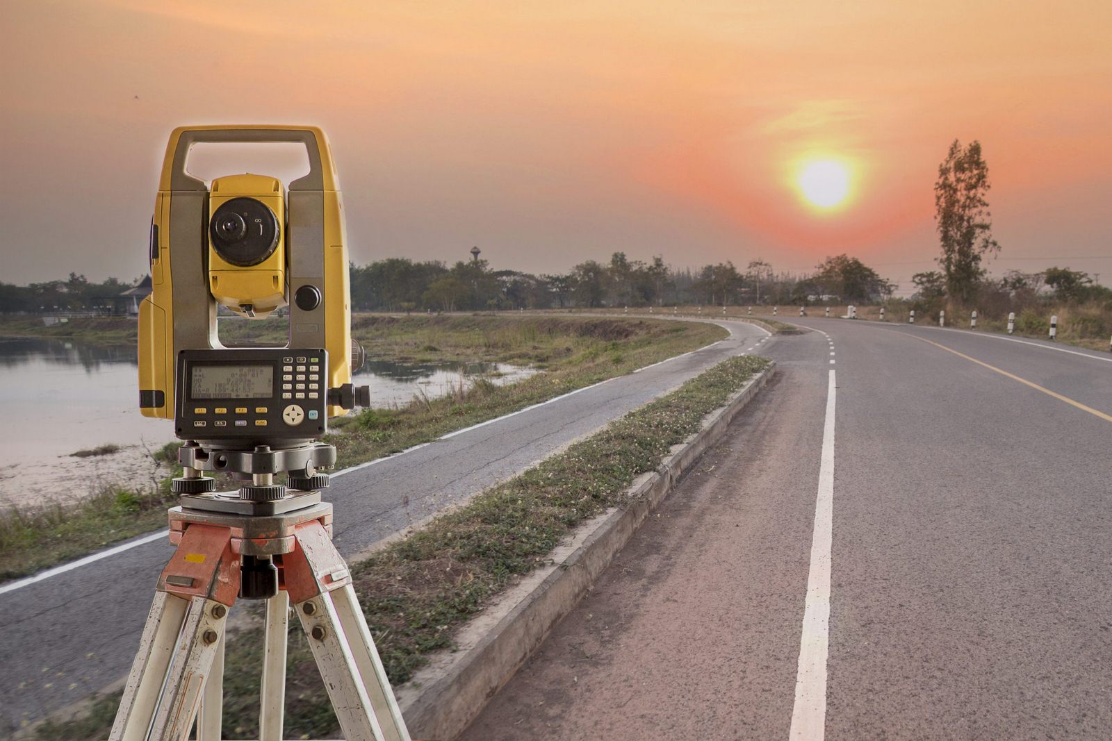
Geodesy
We carry out all types of geodetic works
Executive geodetic survey
A specialized complex of geodetic works, which is aimed at identifying deviations from the architectural design.
Geodetic works during the installation of technological equipment
The main task of carrying out geodetic works during the installation of technological equipment is to ensure the design position of the equipment.
Deformation observation
Deformation of structures is a change in the shape and size of a structure (or part of it) under the influence of loads and influences. Each building has a calculated height, position in space. To understand that the building maintains a given position or has changed it, you need the help of specialists. Survey engineers identify and track the causes of deformations in buildings and structures.
Geodetic support of construction
Geodetic support of construction is a complex of geodetic works that reflect the actual positioning of buildings and objects on the ground, as well as underground engineering networks and the relief of the site.
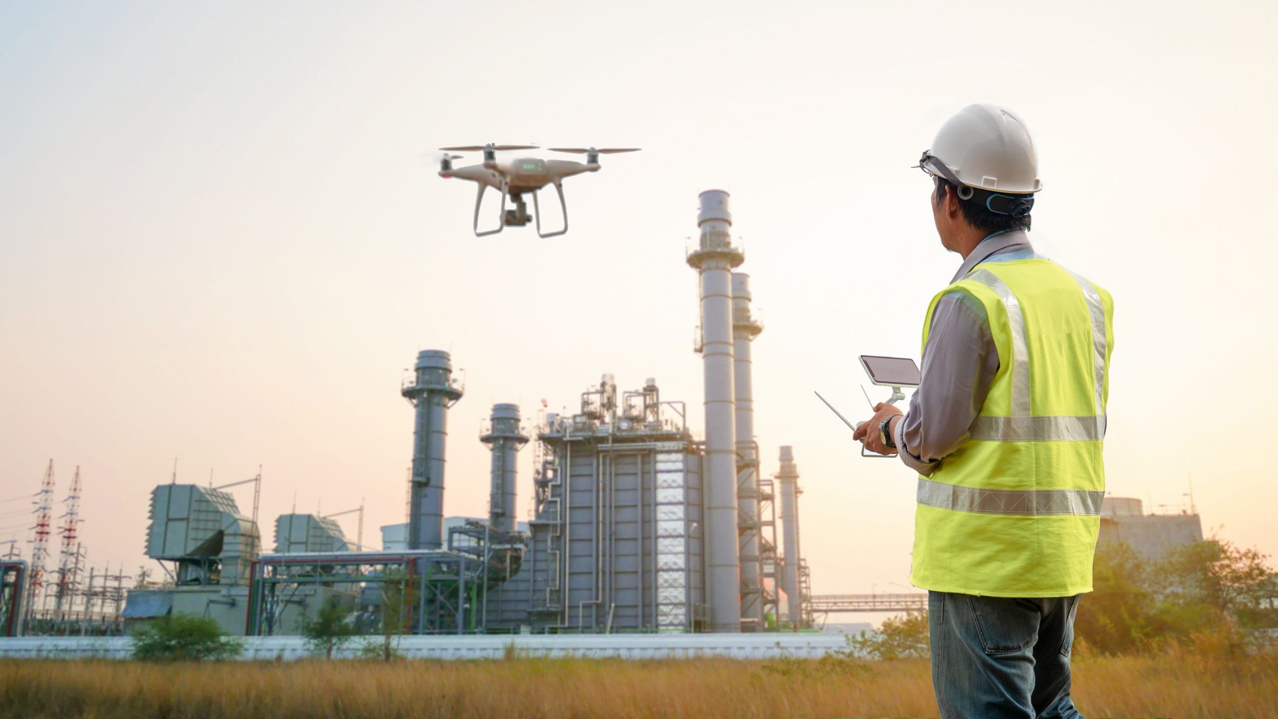
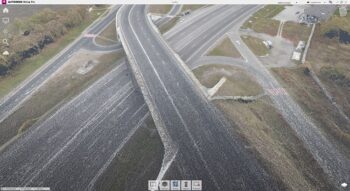
Aerial photography
Aerial mapping
Measurement of area and volume
With the help of new technologies and a drone, it is possible to measure the cultivated areas, the size of the fields, unused areas, the areas of quarries, etc. Thus, you can get information that is later used in business plans, project development.
Orthomosaic creation
Creation of orthophotomaps – obtaining large-scale photographic plans of the area with precise reference to a geodetic base. They are used for topographic, geological, hydrological and environmental surveys, as well as for the needs of land management, design of architectural and infrastructure facilities, quality control of construction and installation works, etc.
Digital elevation model
The creation of a digital elevation model is a reflection of the relief in the form of an array of its points with their known coordinates in space.
3D terrain model
Georeferenced photorealistic 3D models of the urban and natural environment are created on the basis of aerial photography from an unmanned aerial vehicle equipped with a professional full-frame camera and lidar.
Topography
Creation of topo plans
Topographic survey of the area at a scale of 1: 500 -1: 2000
We produce high-precision topographic plans of the area using modern equipment and software.
Geodetic survey for design
Geodetic survey for design is an integral and important process that is implemented at every stage of construction. The main task of geodetic surveying during design is not only a thorough study of the constituent elements of the structure and territory, but also obtaining the necessary permits.
Coordination of underground networks
Coordination of underground networks is the final stage of research on the compliance of all utilities with the further safe operation of the property. In the process of implementing the construction process, the approval of underground networks acts as a guarantor of the operational safety of the structure at the state level.
About Us
Modern technologies of 3D scanning and creation of 3D models have entered our life for a long time – they are used in almost all spheres of life.
Our company offers services for engineering scanning of buildings, facades, streets, apartments, residential and non-residential premises, industrial facilities, marine structures and ships, cultural heritage sites, we create 3D models, BIM models, drawings, we carry out various geodetic and design work.
In addition, an important area of our activity is reverse engineering, which consists in 3D scanning of parts of any size (from several centimeters to several meters) and preparation of all design documentation for its subsequent production on CNC machines or 3D printers.
We are an authorized reseller in Ukraine of the RANGEVISION trademark. Here you can buy, get advice, order training in scanning with RANGEVISION equipment.
We work anywhere in the world, we have extensive experience in various fields. We guarantee the security and confidentiality of our clients’ data.
When performing the following tasks, laser scanning and related products can significantly save time and money:
• Measurement work
• Restoration of project documentation
• Detection of inconsistencies
• Reconstruction
• Estimation of the volume of materials
• Restoration of facades or other decorative elements
• Urban planning
• Comparison of the design and actual positions of the object
• Development of visualization of appearance
• Preservation of cultural heritage
• Transfer of the object to the environment of information modeling (BIM)
We work anywhere in the world, we have extensive experience in various fields. ScanyWell offers a wide range of products and services:
o Geodetic survey of territories.
o Creation of a planning and high-rise feasibility study of construction objects.
o Creation of a planning and high-rise feasibility study of construction objects.
o Layout of the characteristic elements of the construction object.
o Layout and fixing of construction lines.
o Executive survey of any elements of the construction site.
o Calculation of the volume of soil, excavation, etc.
o Facade photography of buildings and structures.
o Determination of deformations and rolls of structures.
o Creation of an orthomosaic of industrial sites (plant, industrial complex, etc.).
o Create precise surfaces of a pit, section, pit, channel, etc.
o Geodetic support of road construction.
o Creation of 3D models of buildings.
o Creation of 3D models of characteristic elements of structures.
o Laser scanning of buildings.
o Creation of orthophotomaps of facades of historic buildings.
o Architectural measurements of buildings (inside and outside in a single coordinate system).
o Visualization

Get Service
Home Menu
Service Menu
OUR OFFICE
st. Bratislavskaya 14-B, office 7
Tel: +380934874980
Tel: +380504003900
Email: 3dscan.ua@ukr.net